Monongahela and Mingo
- Date
- May 28, 2023
- Distance
- 70.0 Miles
- Location
- Pittsburgh, PA
- Komoot
- https://www.komoot.com/tour/1140731546
I’ve never been a huge road cyclist- I usually prefer the comfort and safety of designated bike trails, and since there’s so many in the Pittsburgh area I’ve never felt the need to venture out. This mindset has kind of limited my choices for places to ride though, and made a lot of places I’d love to see inaccessible. Most things, in general, are not along bike paths.
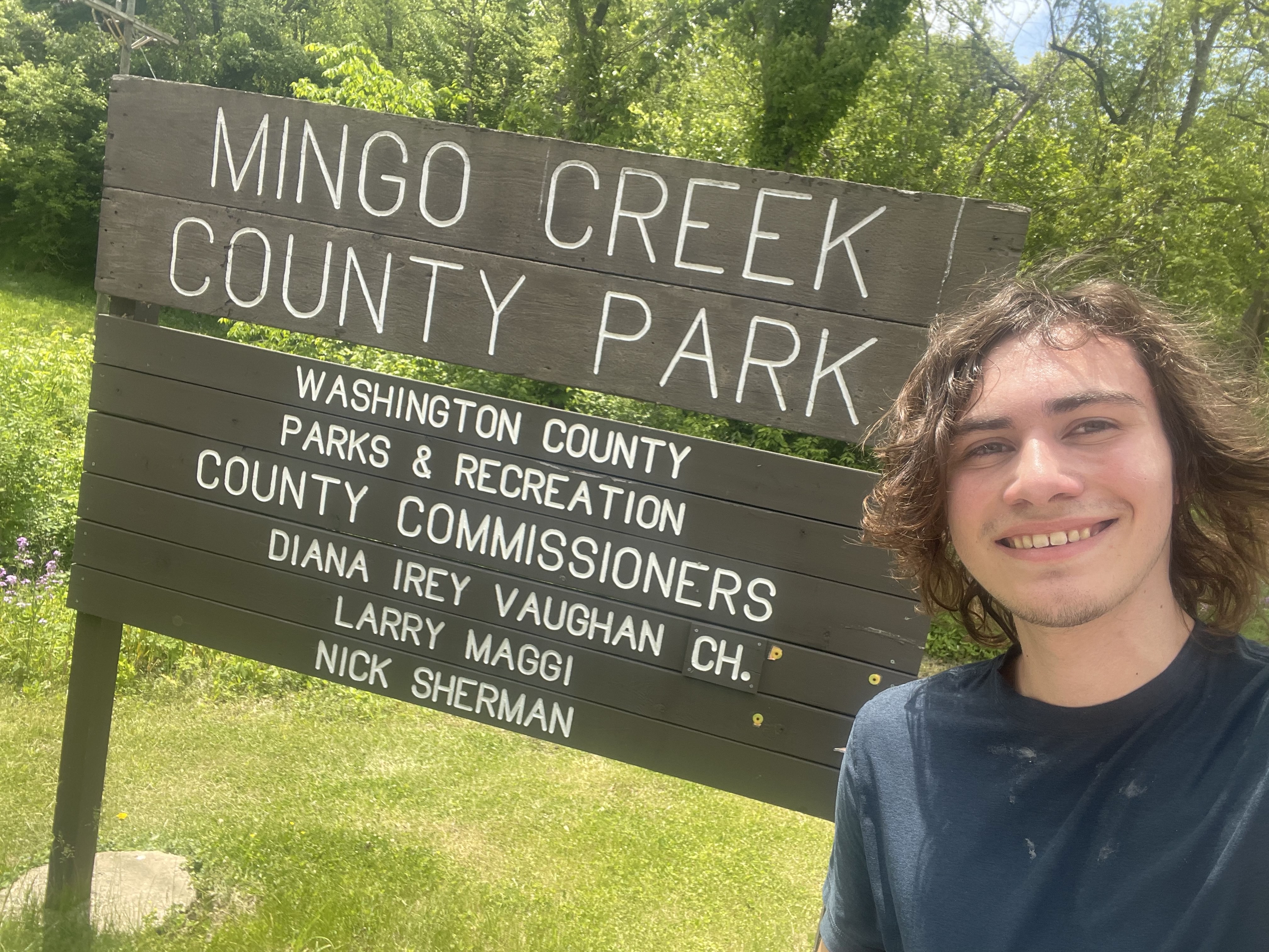
So this Memorial Day Weekend, I decided to venture into the unknown of road cycling and explore some area not bound to the Three Rivers Heritage Trail I had gotten so used to. I ultimately decided on riding to Mingo Creek, a park south of Pittsburgh famous for its old-timey covered bridges and a destination hailed by a Pittsburgh road cycling book as one of the finest in the area.
The Ride
The route to Mingo Creek and back was generally laid out by the aformentioned book, but I filled in some of the finer details to craft a route that had me following the Monongahela river for a while before cutting over to the park and taking a hillier, more direct route back.
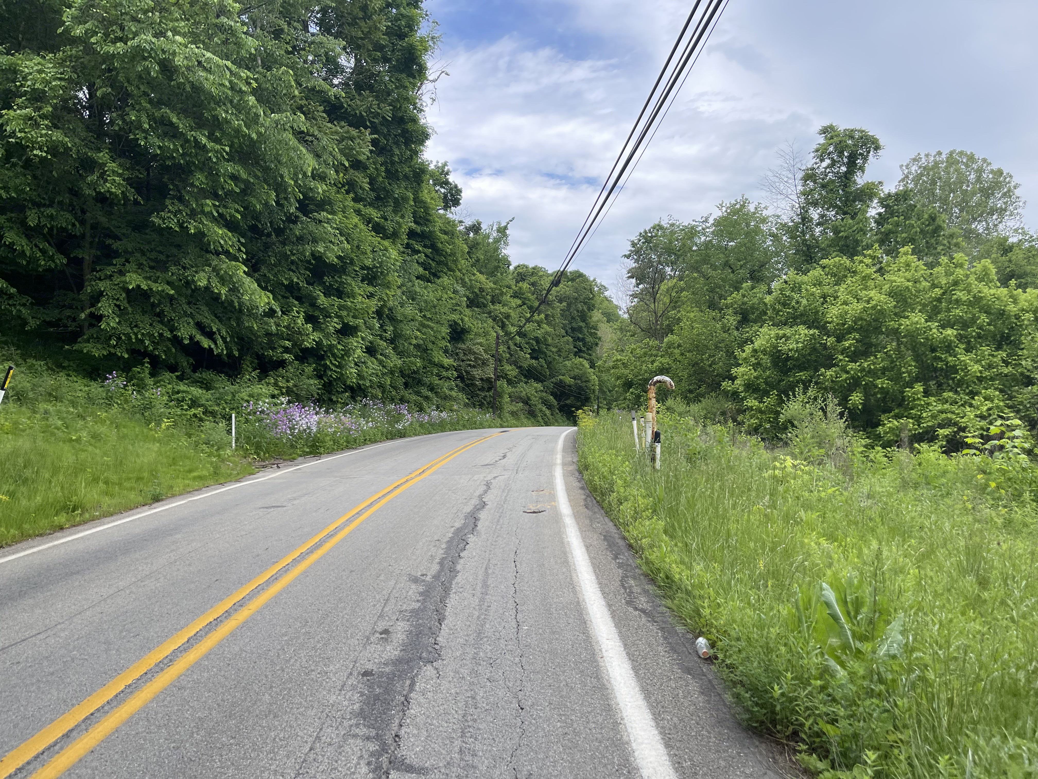
After a fifteen-mile section of familiar trail riding between CMU and McKeesport, I set off South along the Monongahela. I’d explored the Youghiogheny river, a tributary of the Monongahela, before on the Great Allegheny Passage, but I was excited to explore the Mon itself. There’s a wide and minimally-trafficked road that runs along the river for the length I went, allowing me to shut my brain off slightly for a nice trail-like experience. I was also blown away by how scenic this section along the Monongahela was, since the road I used had a constant view of the river and some beautiful greenery around it.
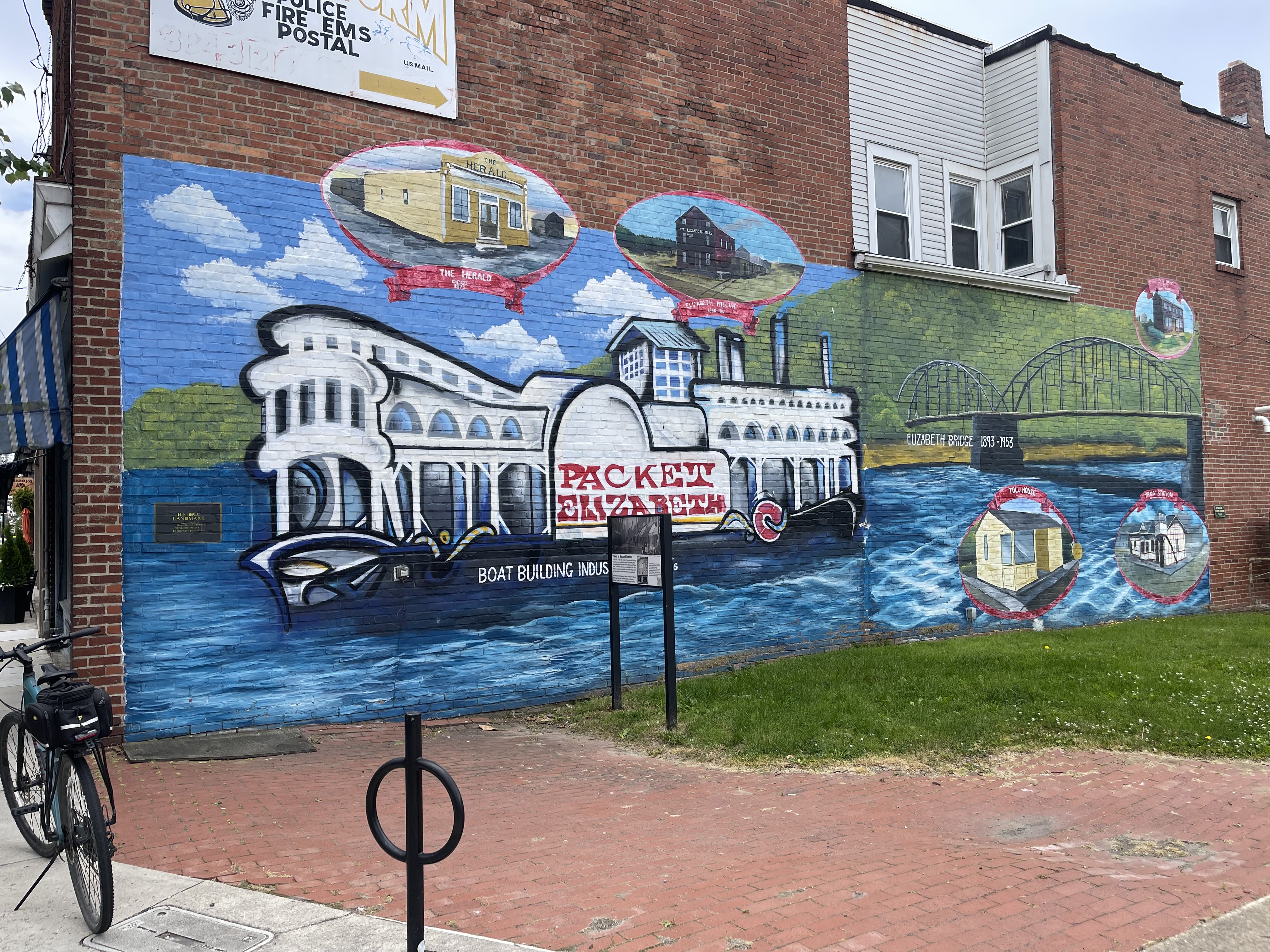
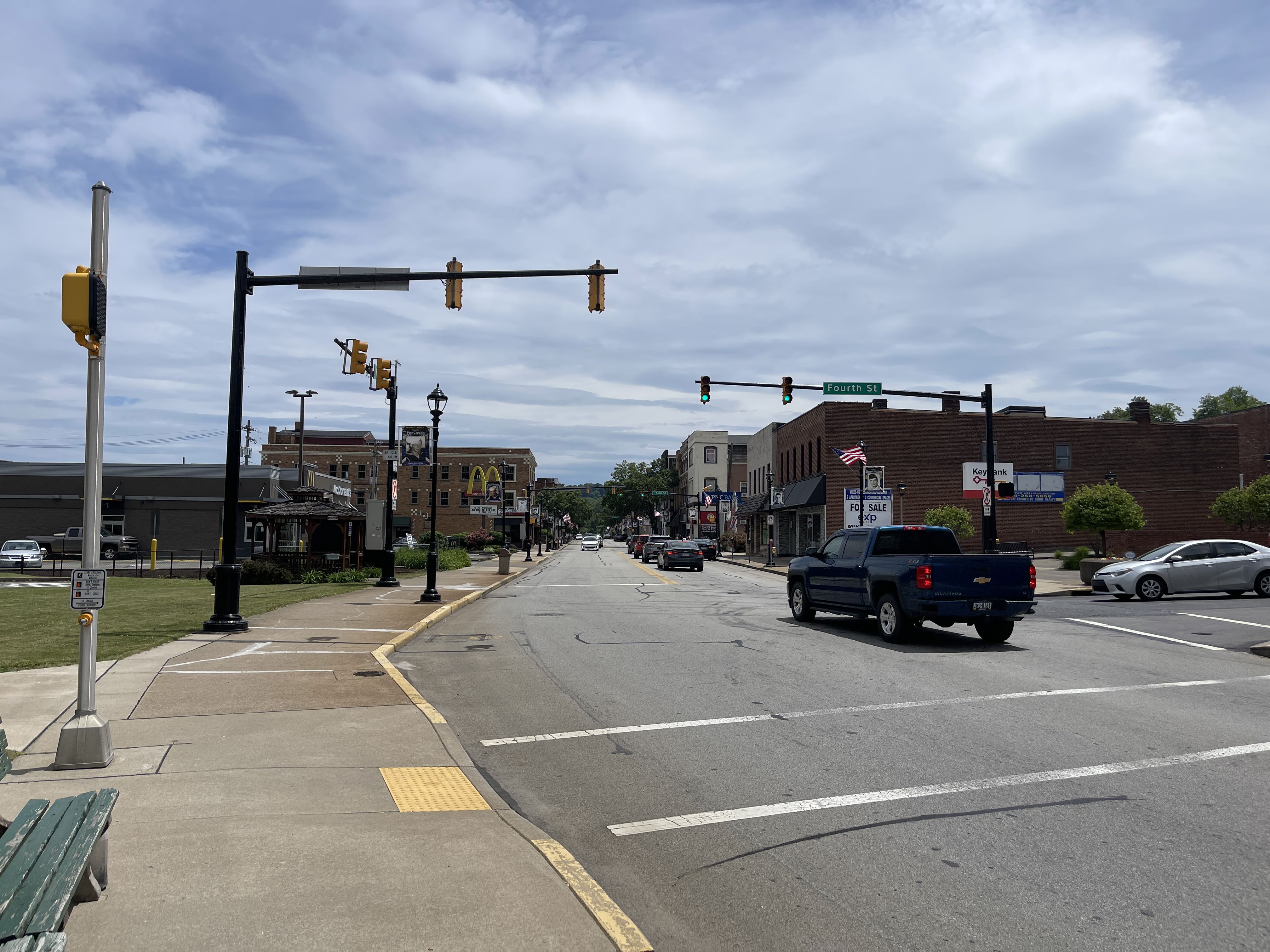
The thing that impressed me the most me about the Monongahela though were the towns on it. I had planned to pass through a few downtowns of places along the river, and while I was interested to see them I didn’t expect anything more than some standard post-deindustrialization suburbs. Instead, I was greeted with a beautiful downtown every few miles, often with walkable streets and vibrant shops and murals. Harkening back to the trail riding dilemma I outlined, I would’ve never been able to stop by these places if I stayed entirely on bike trails.
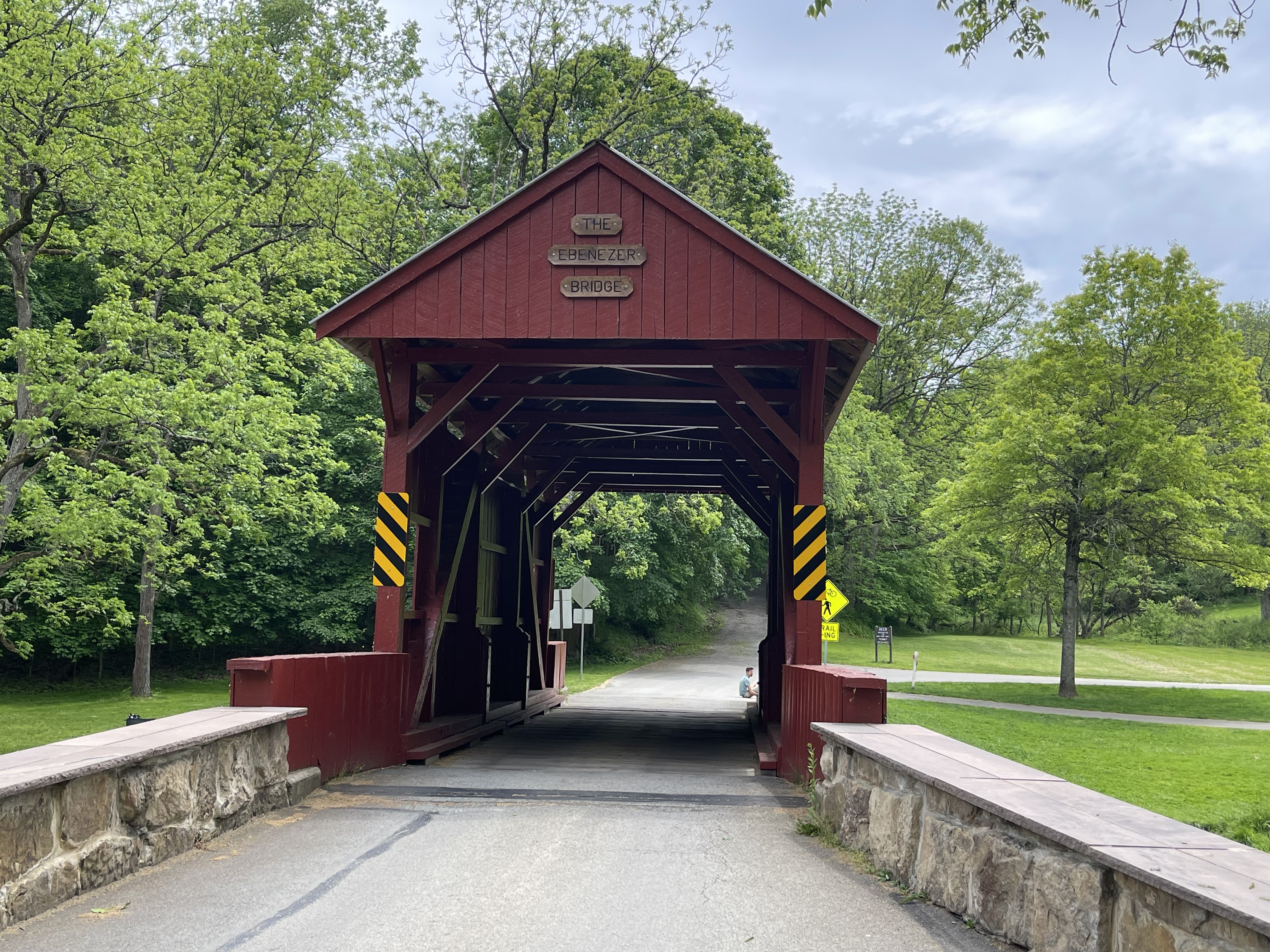
After 20 or so miles along the river, I headed inland for Mingo Creek itself. The few miles between the river and the park weren’t too bad, though there was a slight elevation gain towards the park from leaving the valley the river creates. The park itself was very nice, coming equipped with a small bike trail running the length of it that I used to explore it. The park was a little crowded being the Sunday before Memorial Day, though most people were just on the fields beside the mini-trail so I only had to evade a few people through the park. I also got to see the touted covered bridge, which was fun to see.
After stopping for a while in the park to have the lunch I packed1 and finishing up the trail through it, I began the 20 mile journey back to Pittsburgh. I had been slightly dreading this final part of the trip since it was by far the hilliest part of the trip (or any trip I’d done before), and it didn’t help that I already felt fairly fatigued by this point.
I’ve never been a big hill person; I rarely ride any hills with more than a 5% gradient for any nontrivial period of time (If you can even call that a hill). Objectively, this part of the ride wasn’t that hilly- only 1600 feet of elevation gain over 20 miles. Still though, I struggled getting up a few of the steeper2 sections more than I’d like to admit. The occasional car honking at me for no reason didn’t help either.
Still, I got to see some interesting areas on the way back. I passed through South Park, another park that happened to be on my way back, with a nice bike lane through it. I also crossed the Montour Trail, a large trail that loops around Pittsburgh that I’ve wanted to ride for a while, which was cool to see.
The back half of this ride led me to eventually be well above my starting location with around 5 miles to go. While this made most of the latter half difficult, it also meant I got to fly down 400 feet of elevation in barely over a mile, which while fun made me realize how far I have to go in my biking if there are people that are able to do that the other direction.
Overall this ride ended up being one of my longest ever, which is exciting (One of my days on the GAP may have been longer, I’m not certain). I enjoyed the ride overall, but I also really like how it showed me my biggest pros and cons of road cycling as opposed to trail riding in the unique sites I saw and the hills I forced myself up. Next time, maybe I’ll try to find a flatter road route (however possible that is in Western Pennsylvania).