The Montour Trail and the Airport
- Date
- June 5, 2023
- Distance
- 103 Miles
- Location
- Montour Trail
- Komoot
- https://www.komoot.com/tour/1154284137
As I first got into biking during my Freshman Year, I became more aware of the suprising number of bike trails that exist around Southwestern Pennsylvania. Besides the flagship Great Allegheny Passage, one that caught my attention was the Montour Trail: A 46 mile trail billed as the longest suburban rail-trail in the United States hooking around Pittsburgh.
I’m staying in Pittsburgh doing asynchronous work this summer, meaning I have a lot of time to explore the areas around Pittsburgh that I wouldn’t be able to during the semester. As such, I thought this would be the perfect time to see a bit of Pittsburgh’s neighborhood and set a new biking distance record for myself in the process.
Getting to the Trail
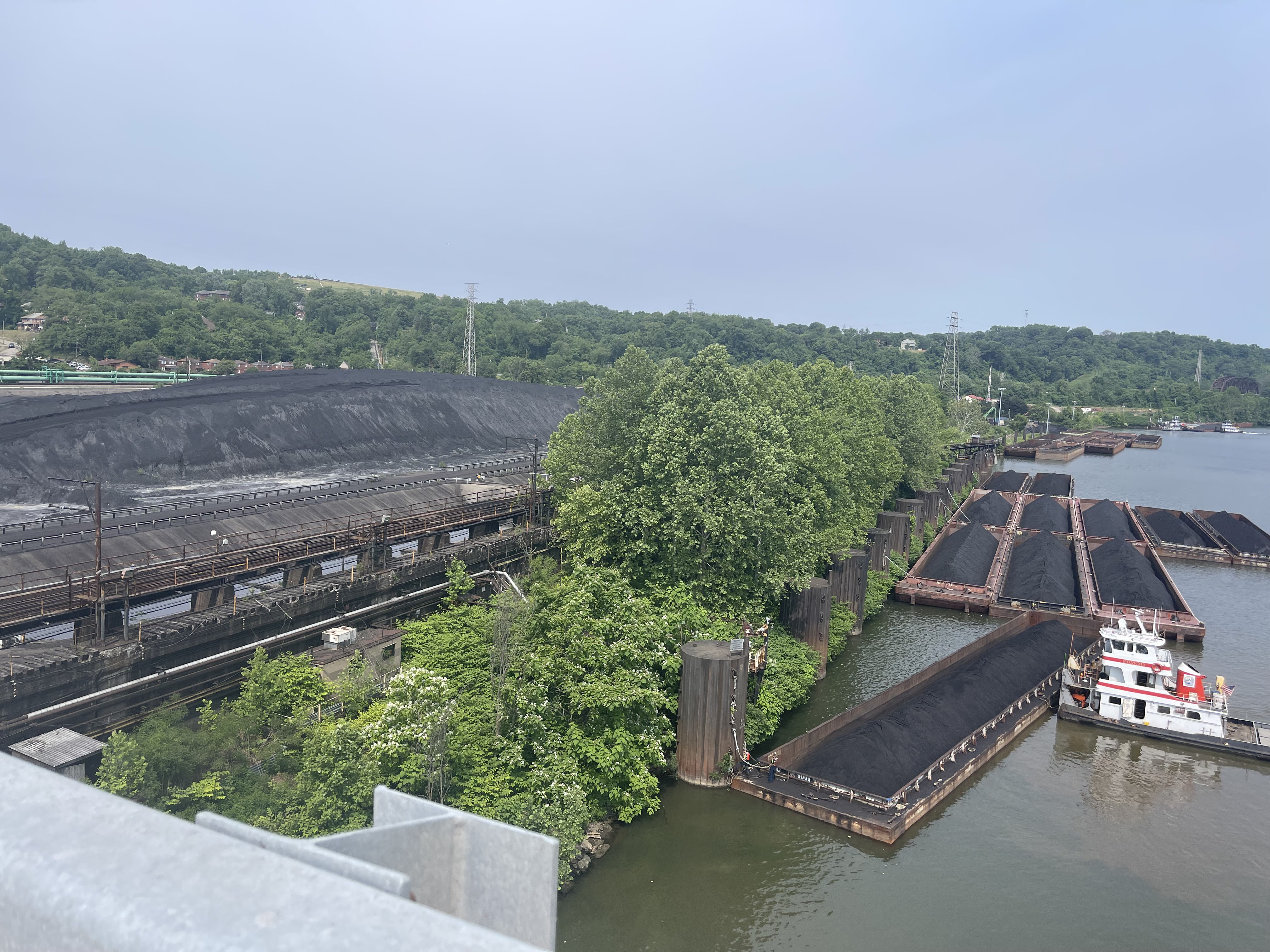
I set off around 9 am, slightly later than I hoped given the length of the ride but still more than early enough for me to get home before sunset. The first 15 miles or so of my trip consisted of me following the Panther Hallow Trail and Great Allegheny Passage down to McKeesport, which served as a nice warmup downhill and on familiar trails.
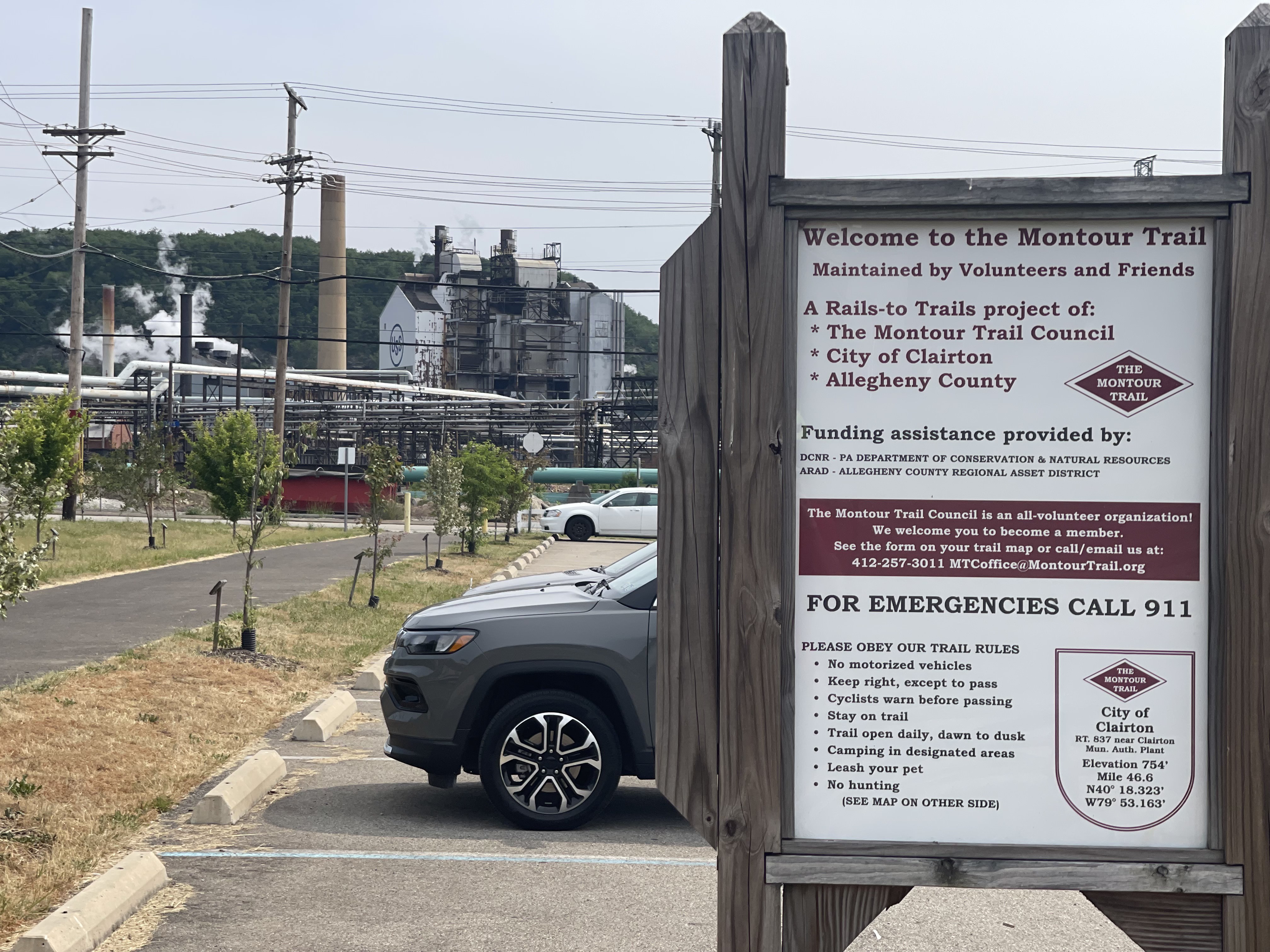
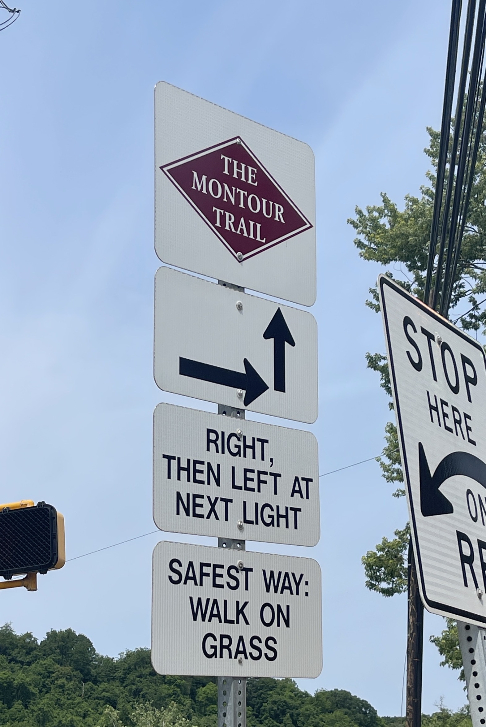
Once in McKeesport, I rode the start1 of the trail itself in Clairton. I think it’s a fairly popular move for riders to connect from the GAP to the Montour Trail, so this five mile on-road stretch had a lot of signs pointing me towards the trail, which was rather convenient. I had also already ridden a portion of this section on a previous ride, meaning I was a little more familiar with it than I’d otherwise be.
The Montour Trail
The first few miles around Clairton aren’t entirely finished, meaning my first hour on the trail consisted of bits of off-road riding interspersed with busy street sections. Some of these incomplete sections were actually relatively scary, so I’m very glad I was able to get them out of the way at the start of my ride before I got too fatigued.
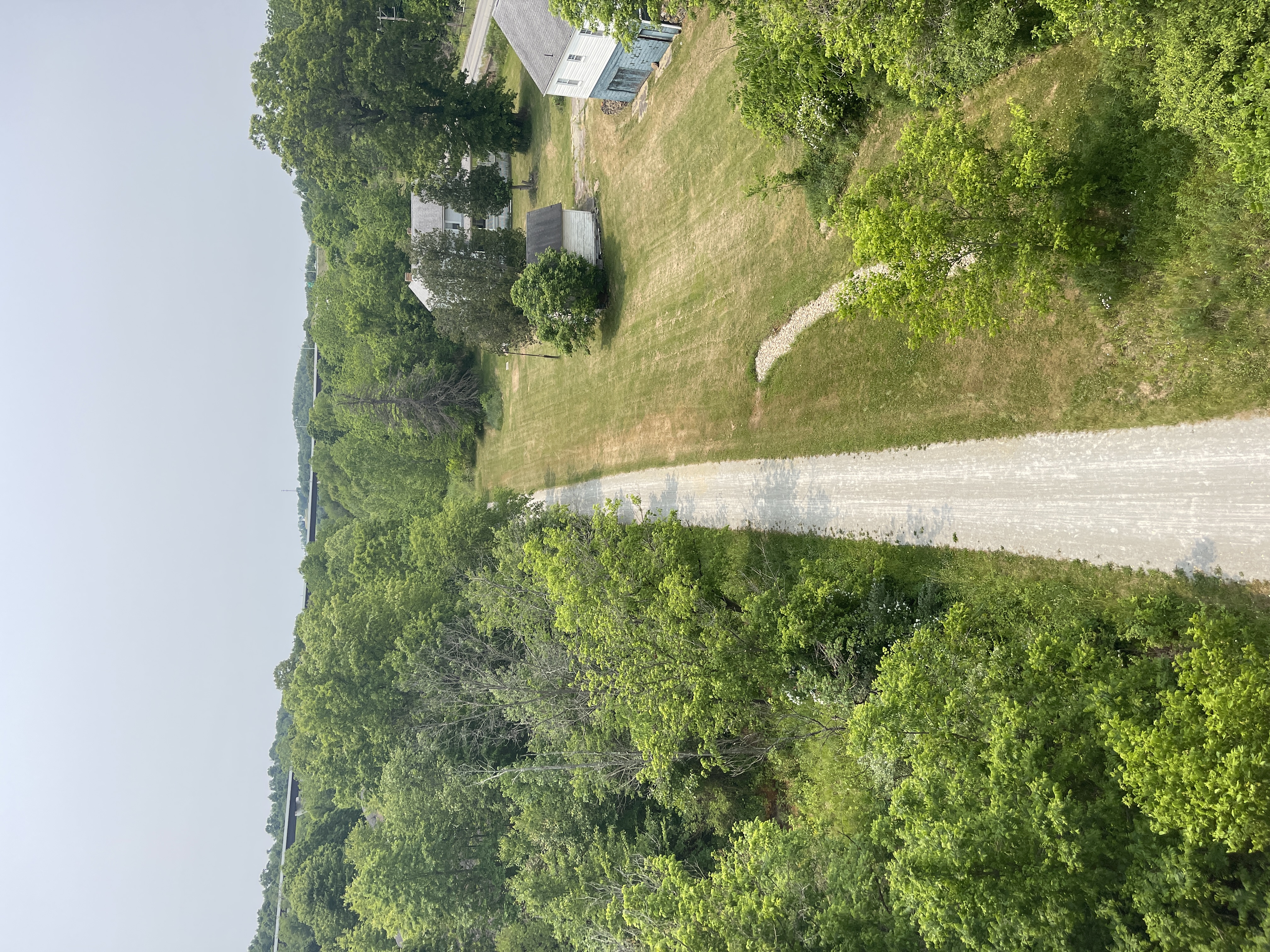
After those first few miles though, the trail quality dramatically improved. The trail is wide gravel for almost its entire length, with bits of asphalt sprinkled in wherever it cuts through an established park. Funnily enough, even though the whole point of a rail trail is to be flat the trail doesn’t really have any truly flat sections at all.2 Rather, it alternated between sections with a 1 percent gradient with and against me. While I usually wouldn’t complain about such a minimal gradient, I definitely began feeling the inclines as the miles wore on and I slowly approached my previous distance record of 70 miles.
The scenery was also phenomenal throughout most of the ride. One complaint I’ve heard about long distance bike trails is the ‘green-tunnel effect’, where trees around the trail make it all look the same. While I definitely noticed this at times, there were some truly great views throughout as well. The whole ride felt very similar to parts of the Great Allegehny Passage a similar distance to Pittsburgh, with beautiful bridges and tunnels and the occasional glimpse past the trees into rural Pennsylvania.
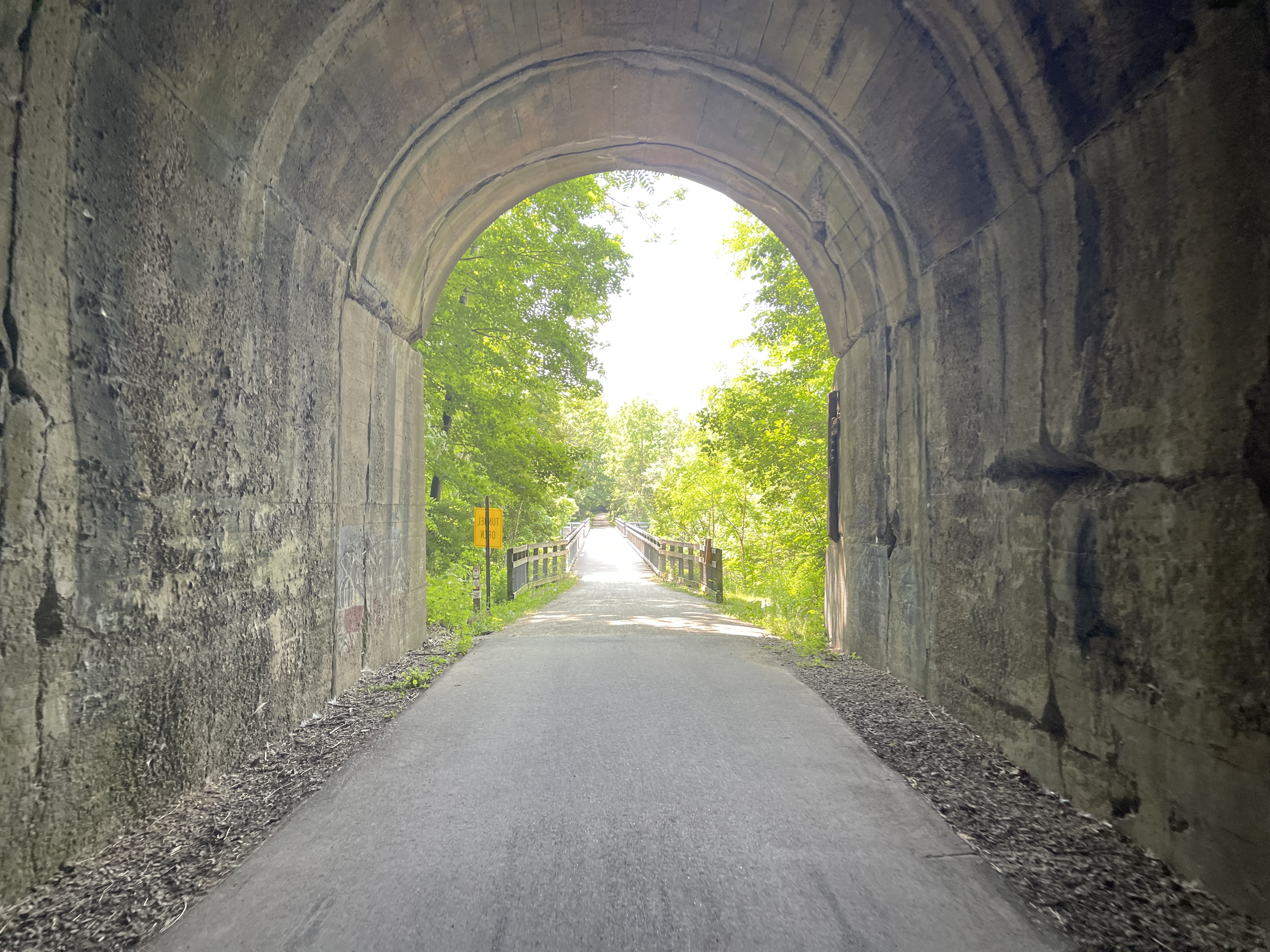
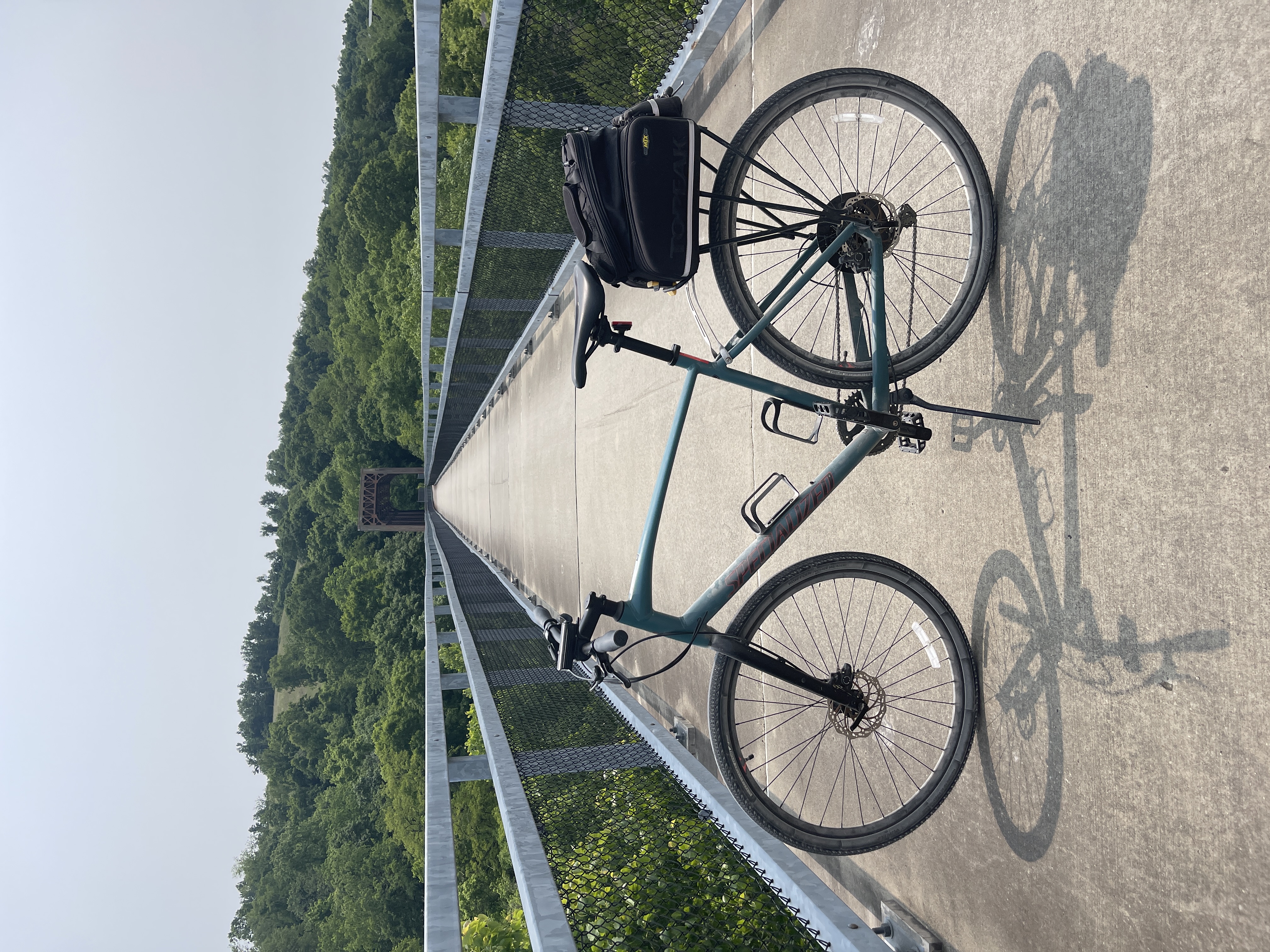
I particularly like the middle photo, as it showcases what may be the coolest thing I’ve seen as a trail rider: a trail running below another trail!3
A Quick Detour
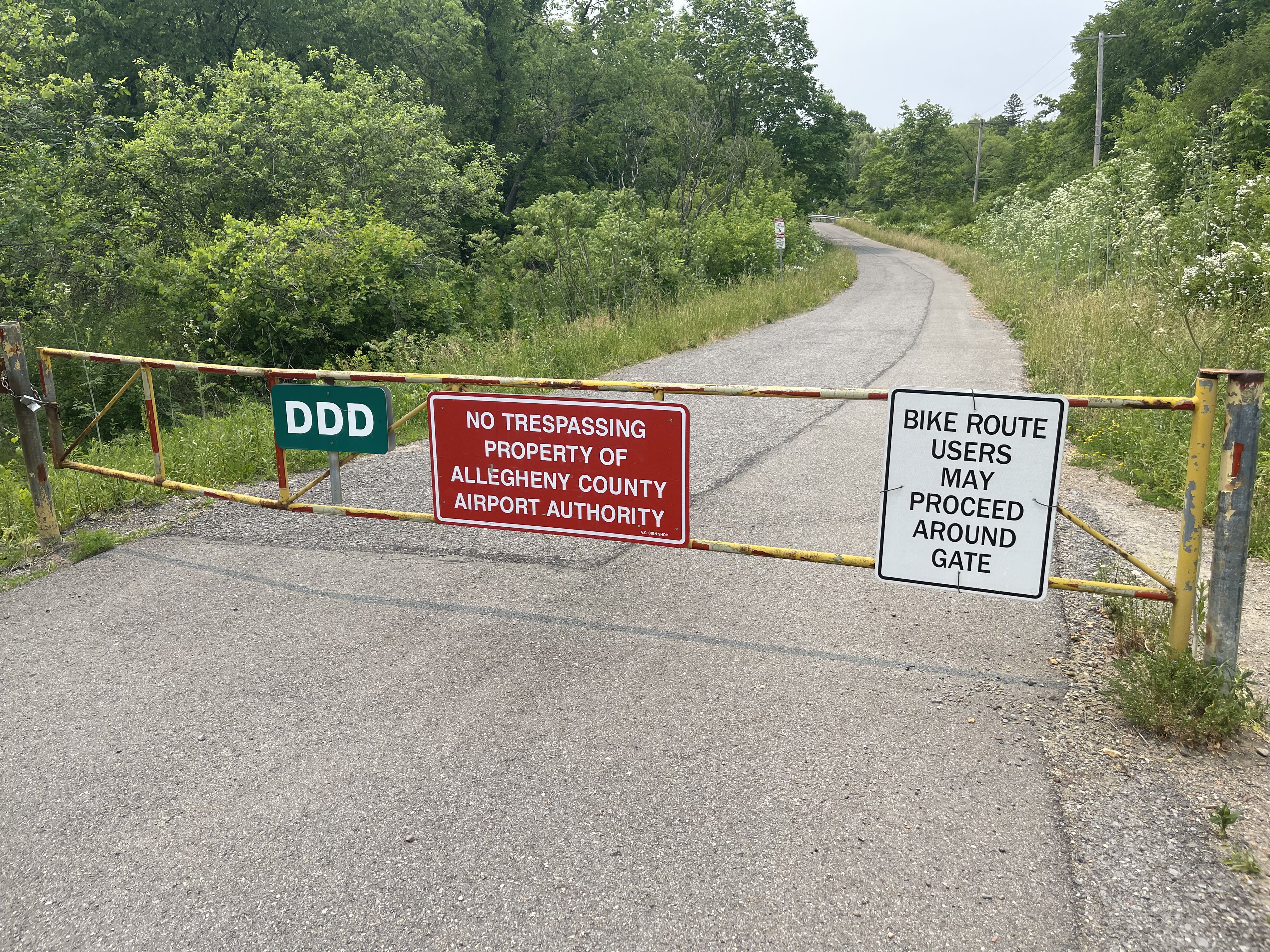
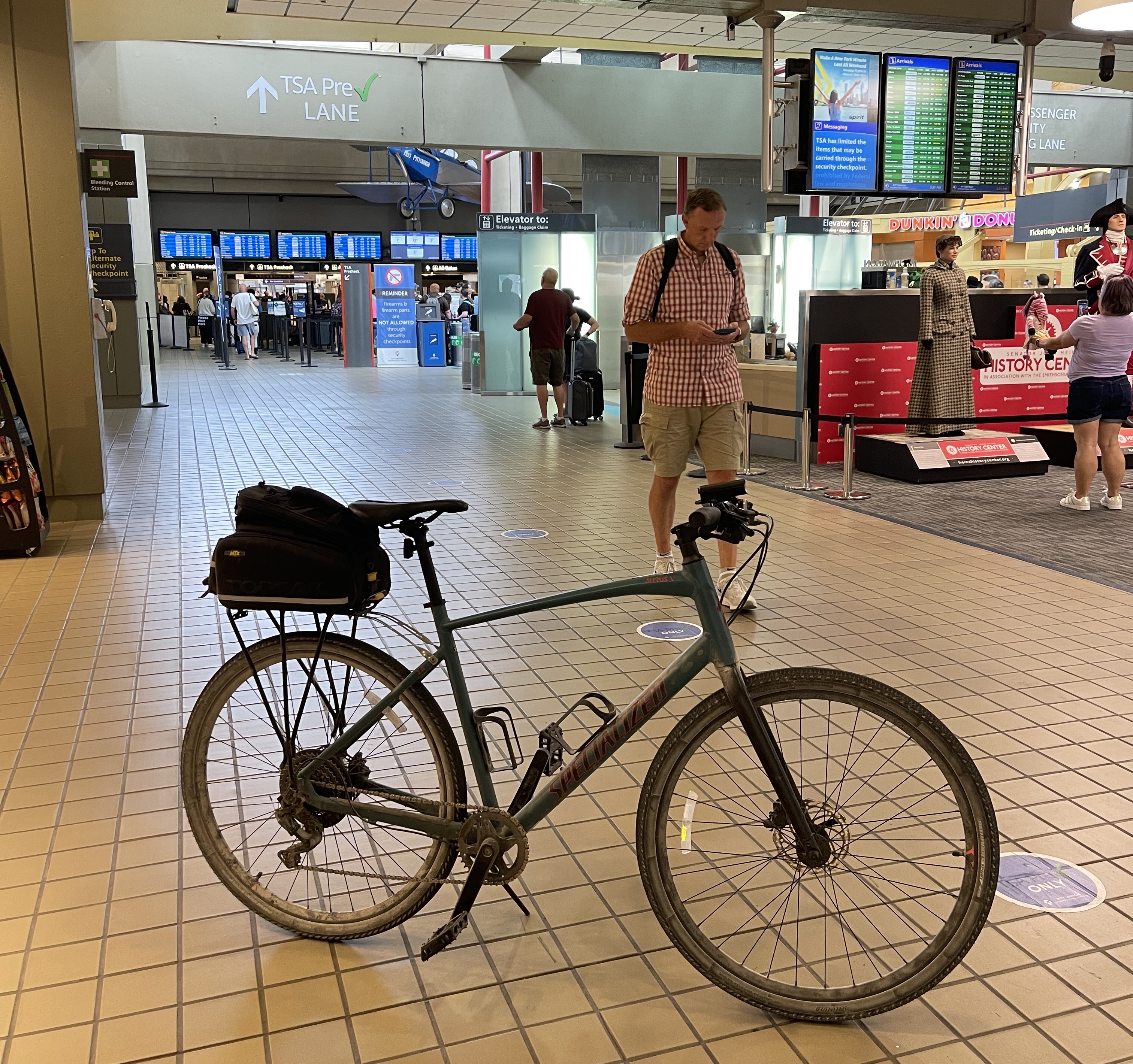
About 35 miles into the trail (61 miles total), there’s a 5 mile on-road path that takes bikes through FAA-regulated territory and leads you to the terminal at Pittsburgh International Airport (how the Montour Trail recieved clearance for a project like this, I have no idea). I was originally just planning on passing by this trail oddity, but my legs were still feeling decent for being 70 miles in and I decided it would be really funny to bike to an airport, so I made the game-day decision to take it. I was also getting very hungry and afraid the food I brought wouldn’t last the whole way, so I’d stock up on something in the terminal.
The trail is slightly surreal because of its placement in a secure airport zone. It felt like every couple hundred feet I would see a sign warning bikers of prosecution if they so much as took a wrong turn, but I really appreciate the fact the trail extension exists at all more than anything. It was also significantly hillier than the converted rail line I had gotten used to, making for a slightly more difficult detour than I had expected.
I couldn’t stop giggling to myself once I reached the airport. Something about juxtaposing the modern efficiency of the airplane with my relatively crude method of travel seemed hilarious to me in my fatigued state. I didn’t stay for too long as to not disrupt anyone actually using the airport, but I got a few nice pictures before settling down outside with a well-deserved Sour Patch Kids and Dr. Pepper I bought inside, along with the lunch I had packed.
I returned from the airport using the same way I came, and reunited with the Montour Trail for a final few miles of easy downhill riding. There wasn’t anything of particular note along this final stretch of trail, other than its continued quality as a solid gravel trail.
Coming Home
I reached Coraopolis at the end of the Montour trail throughly exhausted and with 15 miles to go. I had been slightly dreading this part of the trip as the only extended off-trail section, meaning I thought I’d have to contend with 60 mile per hour motor vehicles in my fatigued state.
After getting slightly lost in Coraopolis itself, my route took me to Neville Island, a large island in the Ohio River which fortunately had a protected bike lane along its spine. Beyond the island, I spent a good few miles on various busy roads on the way towards Pittsburgh proper. There isn’t any great biking infrastructure on the South Side of Pittsburgh past the Point, and I almost wish I had done this route the other direction to get all of the major road riding over with.
Although I hadn’t planned it when I first set out, my detour to Pittsburgh International Airport made this ride into my first century! I had always wanted to complete a century as the ‘big milestone distance’ of cycling, and it felt great to finally have done it myself. I really couldn’t have picked a better place to do my century ride either; I got to spend most of my ride without having to worry about cars around me and on incredibly flat trail to prevent an early burnout. Definitely worth checking out for anyone biking in Southwestern PA.
-
Technically the end according to mile markers on the trail. ↩
-
Not by the textbook definition anyways; the whole thing is incredibly flat by Pennsylvanian standards. ↩
-
The Panhandle Trail, specifically. There’s a connector trail between the two around halfway on the Montour Trail, which is awesome in my opinion. ↩